59.5
Fair
Property score
59.5
Fair
Overall 59.5
Smaller but newer than most nearby homes
1,029 sqft (bottom 11%)
Built in 1926 (10 yrs newer than avg)
Located in a high-income area
with median household income of ~93k
Transit 82.0
5-min walk to transit with 5 nearby routes
Within 500m: 10 dining spots, 1 school, 3 healthcare facilitys, and 2 shops nearby
Living Area
Below average
37% smaller than neighborhood avg.
Year Built
Above average
10 yrs newer than neighborhood avg.
Mother tongue
English · 85%French · 3%
Property score
59.5 is composed by the two sections below.
Property Score
Community Score
Past 10 years Wolseley sales snapshot (~80% of all data)
820
382.5k
$285/sqft
1916
Need help understanding this property?
Buying a home is more than a transaction. Our Winnipeg real estate agents provide market insights, pricing analysis, and neighbourhood expertise to help you decide with confidence.
Usually replies in a few minutes
Get the full property report
- Exact sold prices
- Detailed market analysis
- PDF report download
- Neighbourhood insights
- Recent sold count in the area
Free · No credit card required

The real estate market is turning around
In Winnipeg this week (May 24), over-asking sales are dropping quickly.
Sales-to-New-Listings
1,465
sold
2,307
new listings
Manitoba Real Estate Association March public data on New Listings and Properties Sold across Manitoba
Sold Above Asking
Majority sold above asking
39 of 75 sold above asking · MLS Winnipeg sold listings 2026-05-18 – 2026-05-24
With a Sales-to-New-Listings ratio of 63.5% and 52% of homes selling above asking price, demand is clearly outpacing supply. Buyers are competing, which is putting upward pressure on prices.
Neighbourhood Sales
Wolseley
How to read: Share of sales in each ~$50k price band for “wolseley” (Detached houses (non-condo), 2024). The tallest band is the mainstream budget range; multi-year view shows how that band shifts over time.
Area census snapshot
Dissemination area (DA) — Statistics Canada 2021 Census · Area: #46110652
Community deep dive
$93K
Median household income
$107K
Average household income
6%
Low income (LIM-AT)
0.2
Income inequality (Gini)
2.8
P90 / P10 ratio
32%
Single-person households
29%
Families with children
Population, labour & age
Households & income
Housing
Diversity, education & language
Figures are for the census dissemination area containing this listing location; sources and margins may apply per Statistics Canada.
Rankings
Tax-Assessed Value
above averageYear Built
above averageLot Size
around averageRank by land area, larger = better rank
Rank by year, newer = better rank
Rank by living area, larger = better rank
Rank by assessed value, higher = better rank
Bar: fill length ≈ share of peers you outperform. Fill color reflects tier (red / blue / amber / gray). "Avg" is a rough median benchmark for comparable homes in that scope.
To see this property on a map next to nearby houses—and compare year built, living area, assessed value, and lot size in detail—open the neighbourhood analysis page.
Transit & Walkability
Nearby stops, routes & transit score
Nearby Amenities
Dining, education, healthcare, shopping & more
152 Sherburn Street — 24 amenities found within 500 m, across 8 categories, including 10 dining (nearest 285 m), 1 education (nearest 487 m), 3 healthcare (nearest 314 m).
Crime & Safety
Wolseley · WPS public data · 2026
Annual incidents
34
2026
vs. city avg
+15%
relative to avg
Year-over-year
▼ -95%
vs. prior year
Primary type
Property
68%
Waste Collection Schedule
Local garbage, recycling, and yard waste pickup schedule for 152 Sherburn Street.
Garbage
friday
Recycling
friday
Yard Waste
friday a
Sales History
Same street
Same area
City-wide
| Metric | Same street | Same area | City-wide |
|---|---|---|---|
Sold price | Top 20% | Bottom 40% | Bottom 44% |
We are licensed Manitoba real estate agents. Contact us to obtain all MLS whole sold records for 152 Sherburn Street. No advertising. Data source details →
Related homes
Nearby interested homes
Address · Year Built · Living Area
Nearby properties
Address · Distance
Similar assessed value
Address · Tax-Assessed Value
Highlights & common questions: 152 Sherburn Street, Winnipeg
152 Sherburn Street – Property Summary
Key Characteristics & Buyer Profile
This 1926-built home on Sherburn Street in Winnipeg’s Wolseley neighbourhood offers 1,029 square feet of living space on a 3,013-square-foot lot. What stands out most is the property’s assessed value relative to its size: the assessment sits at $316,000, notably above the street average of $266,000 and ranking in the top 16% on Sherburn Street. Meanwhile, the home’s living area is slightly below both the Wolseley community average (1,622 sq ft) and the citywide average (1,342 sq ft). The lot is also smaller than typical for Winnipeg overall, but sits close to the norm for both the street and the neighbourhood.
The appeal here is less about raw square footage and more about value density. The home holds a higher assessed value than many larger properties on the same street, which may reflect updates, location advantages, or lot characteristics not captured by floor area alone. The building itself is newer than the Wolseley median (built 1926 vs. 1916), placing it in the top 13% of the neighbourhood for construction year—meaning it’s relatively modern by local standards.
This property would suit buyers who prioritize a modest, manageable footprint in an established neighbourhood, and who are willing to pay a premium for a well-located home with strong assessed value. It may appeal to people who value older character areas but want something slightly newer than the surrounding stock, or to those who see the higher assessment as a sign of long-term stability rather than a stretch. First-time buyers, downsizers, or investors focused on Wolseley’s desirability could find it a practical fit.
Frequently Asked Questions
1. How does the property’s size compare to others in Wolseley?
The home is smaller than the neighbourhood average. Its living area (1,029 sq ft) ranks in the bottom 11% of Wolseley, and the lot (3,013 sq ft) is also slightly below the community median of 3,434 sq ft. On its own street, however, both figures are close to typical.
2. Why is the assessed value higher than the street average despite the smaller size?
Several factors can drive assessed value beyond square footage, including the condition of the home, recent renovations, lot characteristics, or its specific location on the block. The assessment data suggests that, on Sherburn Street, this property holds above-average value relative to its neighbours.
3. Is the 1926 build considered old for the area?
No—by Wolseley standards, a 1926 home is actually newer than most. The neighbourhood’s average build year is 1916, putting this property in the top 13% for age. Compared to the citywide average of 1966, however, it is older.
4. Who typically buys homes like this in Wolseley?
Buyers are often people drawn to Wolseley’s walkability, tree-lined streets, and older character, but who want a home that doesn’t require major structural updates. The smaller footprint also appeals to those looking for less upkeep or a lower entry price point in a desirable area.
5. What does “ranked 86th out of 537 on the street” for assessed value mean in practical terms?
It means this home is valued higher than about 84% of other properties on Sherburn Street. For a buyer, this could indicate that the home has retained or gained value well relative to its immediate neighbours, which may be a positive sign for resale potential.
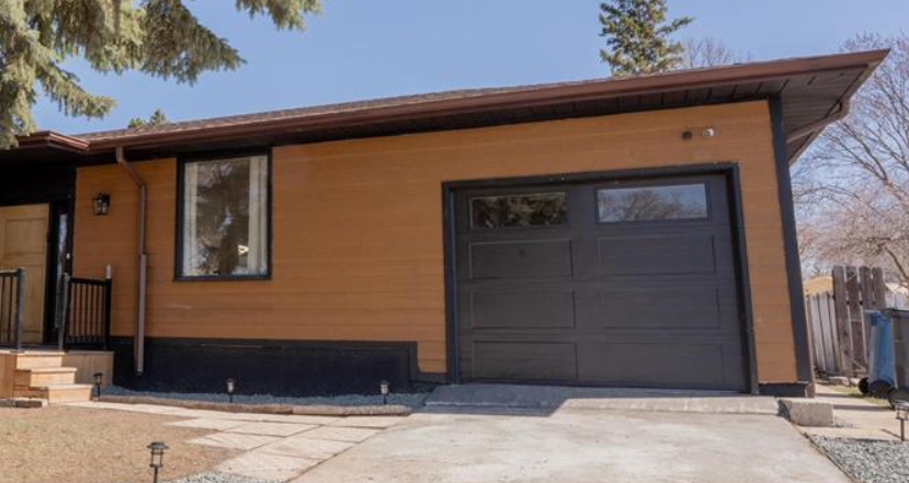
Map & Street View
Radar charts, rankings, and side-by-side layouts work best on a larger screen. Open this page on a desktop browser for the full experience.